Project Pressure’s Indonesia Expedition Maps Papua’s Disappearing Tropical Glaciers
Project Pressure conducted a groundbreaking expedition to Papua, Indonesia, to survey the significant remaining glacier on the Puncak Jaya mountain and generate a visual legacy of the rapidly disappearing ice.
ETERNITY GLACIERS
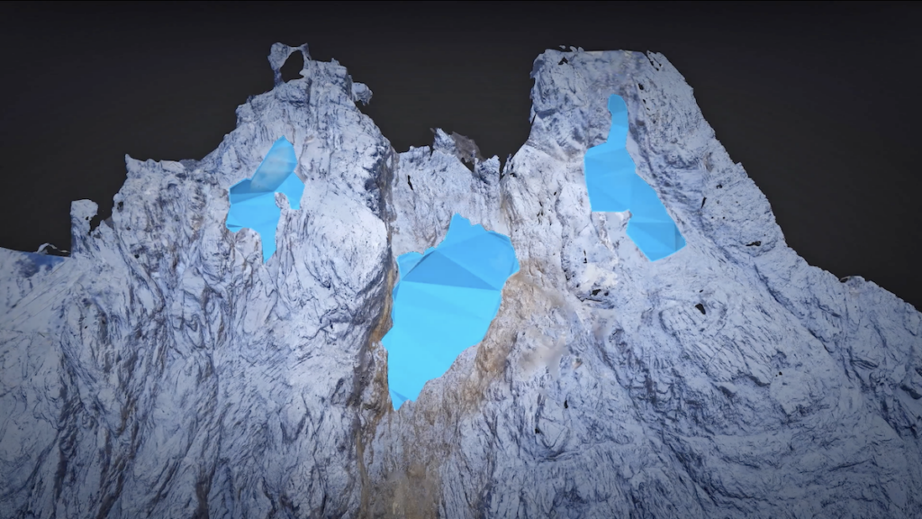
Puncak Jaya, one of mountaineering’s legendary Seven Summits, is rapidly losing its glaciers. Project Pressure captured what is left of the ice in a stunningly detailed, and centimeter-accurate, 3D photogrammetry model.
Despite its equatorial location, Puncak Jaya has been able to support glaciers due to its high altitude, reaching 4,884 meters above sea level. The ice bodies on the mountain are locally called Salju Abadil, meaning eternal snow, often translated in English as the “Eternity Glaciers.”
The imminent disappearance of equatorial tropical glaciers, like those on Papua, reflects the urgent consequences of our warming planet on its ecosystems and local communities that live near the glaciers. Led by scientist and explorer Klaus Thymann, the project builds on a long history of innovation in glacier work. The new 3D photogrammetry model is a world’s first and the most visually comprehensive survey of this glacier.
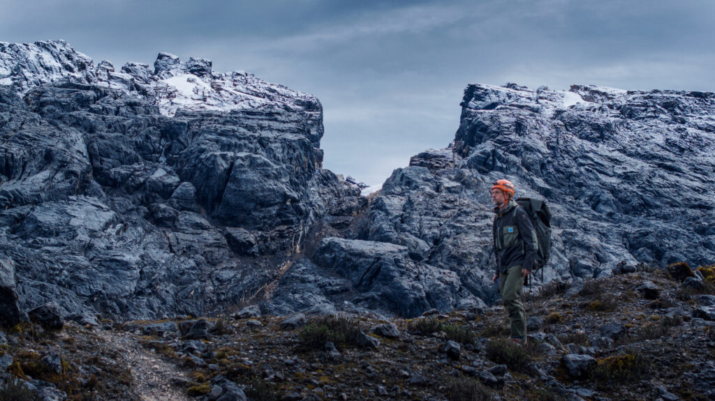
Field operations were constrained by security conditions, which required helicopter-only access to basecamp, as well as persistent cloud and heavy rainfall. But, despite a narrow weather window, the team achieved a successful clear-sky survey of the glacier ice and surrounding peak.
The expedition was the third successful outing for Project Pressure’s Melting Topics expedition series, which undertakes fieldwork capturing area data and rich imagery to create detailed 3D photogrammetry models of threatened tropical glaciers. Uganda and Boliva are the other survey regions to date. The models and data are shared for scientific study and as a visual reference for future generations.
SURVEY FINDINGS
• The East Northwall Firn glacier has decreased in area by approximately 95% since 2002, according to our calculations
• This glacier has persisted beyond previously published estimates that forecast full retreat by 2025/2026.
KEY EXPEDITION ACHIEVEMENTS
• Created the first 3D photogrammetry model of remaining ice on the East Northwall of Puncak Jaya, an ice legacy for future generations
• Collected a georeferenced dataset supported by high-accuracy ground control points
• Captured aerial documentation of the glacier and peak through images and footage
ABOUT THE MOUNTAIN & EXPEDITION
Puncak Jaya, sometimes referred to as Carstensz Pyramid, is the highest point in Oceania. In recent years, access for mountaineering and research has been impacted by the political and security context in Papua. The mountain was closed to climbers for several years due to armed conflict. Limited operations have resumed, but the government no longer allows ground treks up the mountain. All access to the mountain is by helicopter to a shared base camp at above 4,000 m.a.s.l. The combination of a short climbing season, limited basecamp transfers, and weather add to the challenge of reaching the mountain.
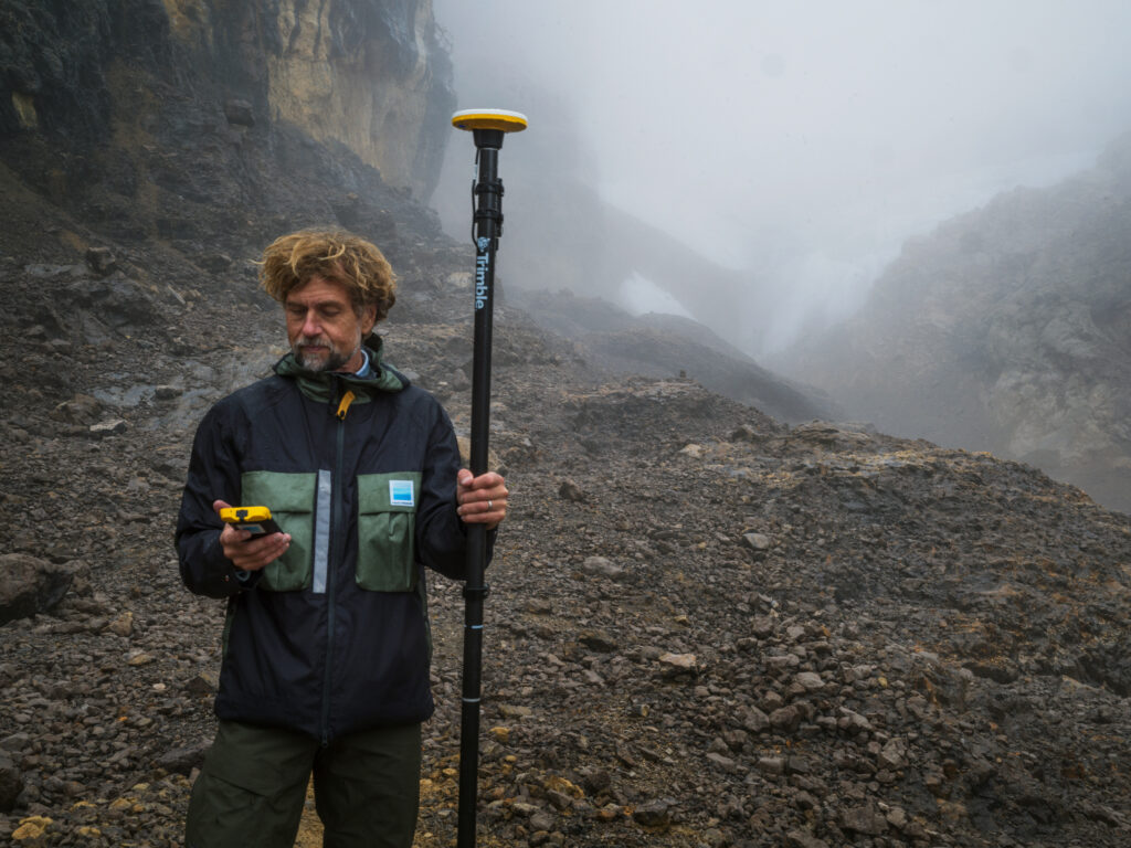
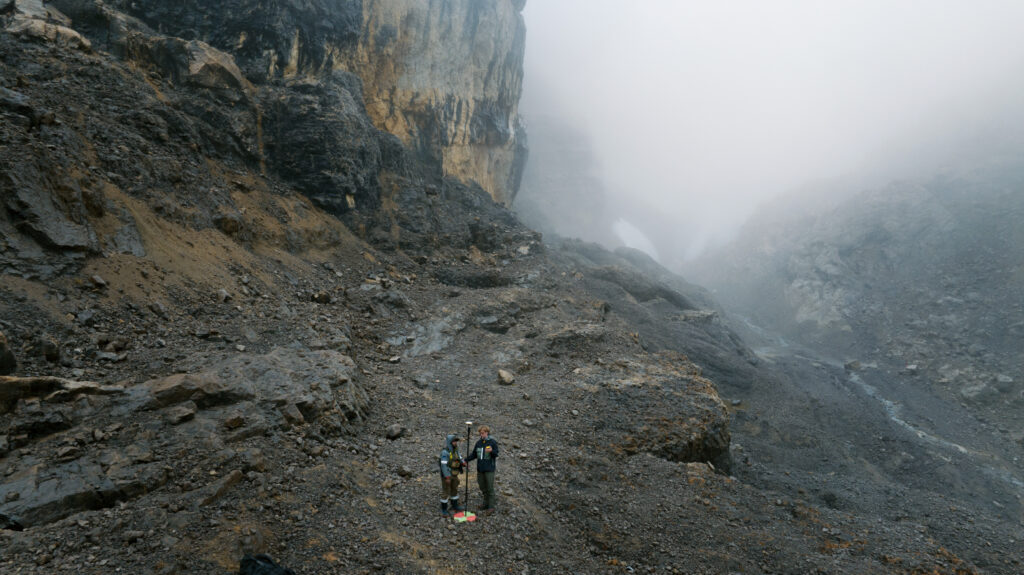
To capture the imagery and dataset required to generate the 3D model, expedition leader Klaus Thymann built on the successful techniques he pioneered for Project Pressure’s Melting Tropics expeditions. Using Trimble Catalyst GNSS positioning service, precise geolocation points were established at multiple sites to underpin the 3D photogrammetry model. While standard GPS offers basic positioning, GNSS delivers greater accuracy by accessing multiple satellite systems. This precision was critical in anchoring the high-resolution drone imagery to exact coordinates. To capture the detailed imagery, Thymann operated a camera-equipped UAV. The data and imagery were then processed in PIX4Dmatic with the support of Pix4D to generate the 3D model. The result is a visually detailed, centimeter-accurate, 3D photogrammetry model that can be to used extract comprehensive area data.
This expedition was generously supported by Parajumpers, Trimble, and Pix4D.